Alaznistavi is the most scenic historical and geographical location, where Tushetian shepherds have grazed sheep from time immemorial. Geographically, Alaznistavi belongs to Gometseri gorge. The distance between Alaznistavi and the Village of Omalo – the administrative center makes 35 km, 20 km of which is the dirt motor road leading to the Village of Koklati, while the 15 km section from Kokalt is a narrow footpath and horse-riding trail that ends in an open valley/gorge, wherefrom the area, including the eastern slopes of Borbalo Mount (3134 m), is known as Alaznistavi.
Alaznistavi is translated as the Alazani river head, because the river Tushetis Alazani (59 km) springs from the eastern slope of Borbalo Mount.
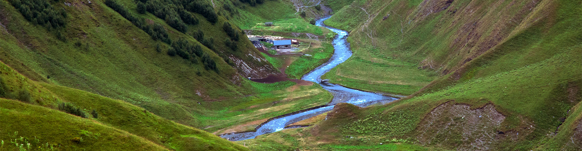
If one goes up-stream the river from the Co-Op “Alaznispiri” enterprise, one will see how opens the valley and how widens the river bottom; already in the upper part, while the Borbalo Mount’s slopes are reached, the most picturesque, sunk in green, open valey with breathtaking panoramic views open up before the spectator’s eyse. From here, on the right bank of the river, a footpath starts, which will, by passing from Alaznistavi the Sakorne Pass and Rkinis (Iron) Mountain, lead down to Kakheti. And where one goes up the path near the river bank, toward the Great Borbalo Mount (3294 m), it will be divided into two footpaths, one of which goes down toward Pshavi, while the other – to Khevsureti by passing the Andaki Pass.
These paths are an incomplete list of the tourists routes which go through Alaznistavi and provoke great interest in the tourists routes on the part of visitors and tourists - lovers of wild nature, adventures, and tourism.